A Series of Maps Reveals the Difference in How Cities are Perceived by Tourists and Locals
Share
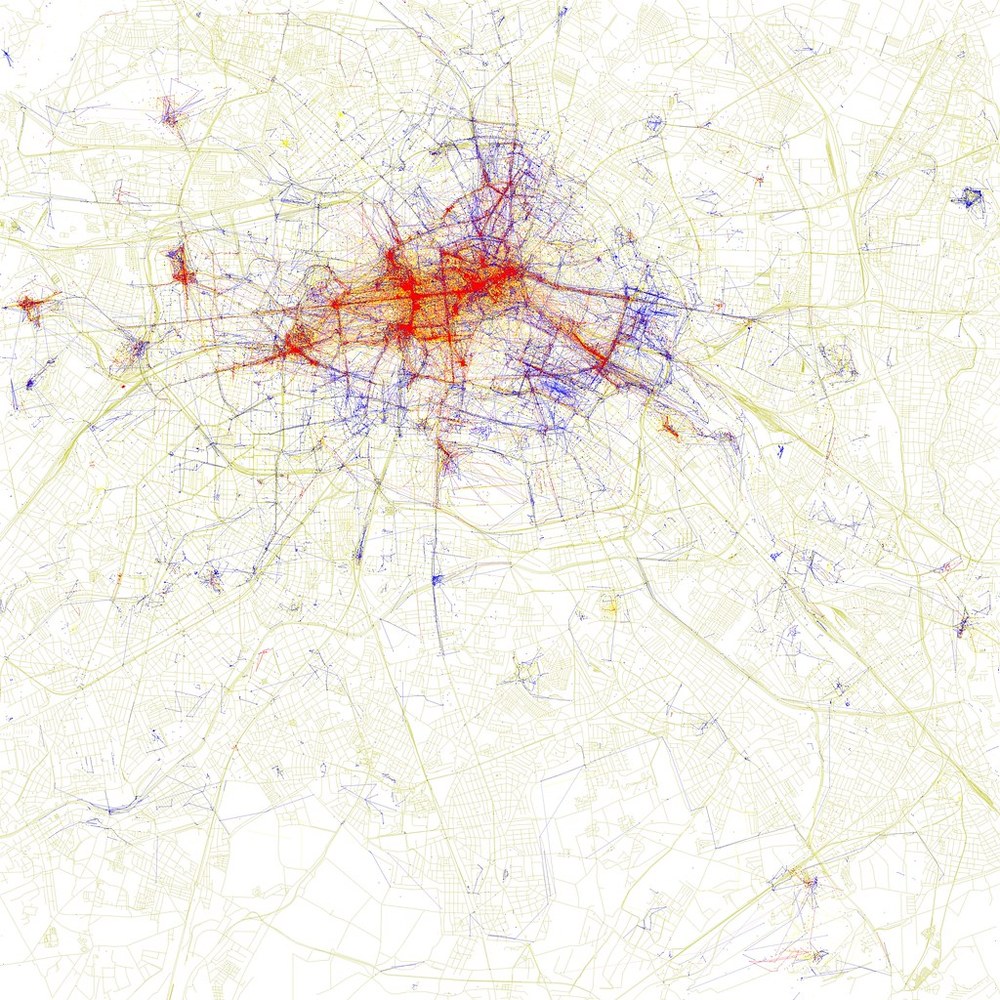
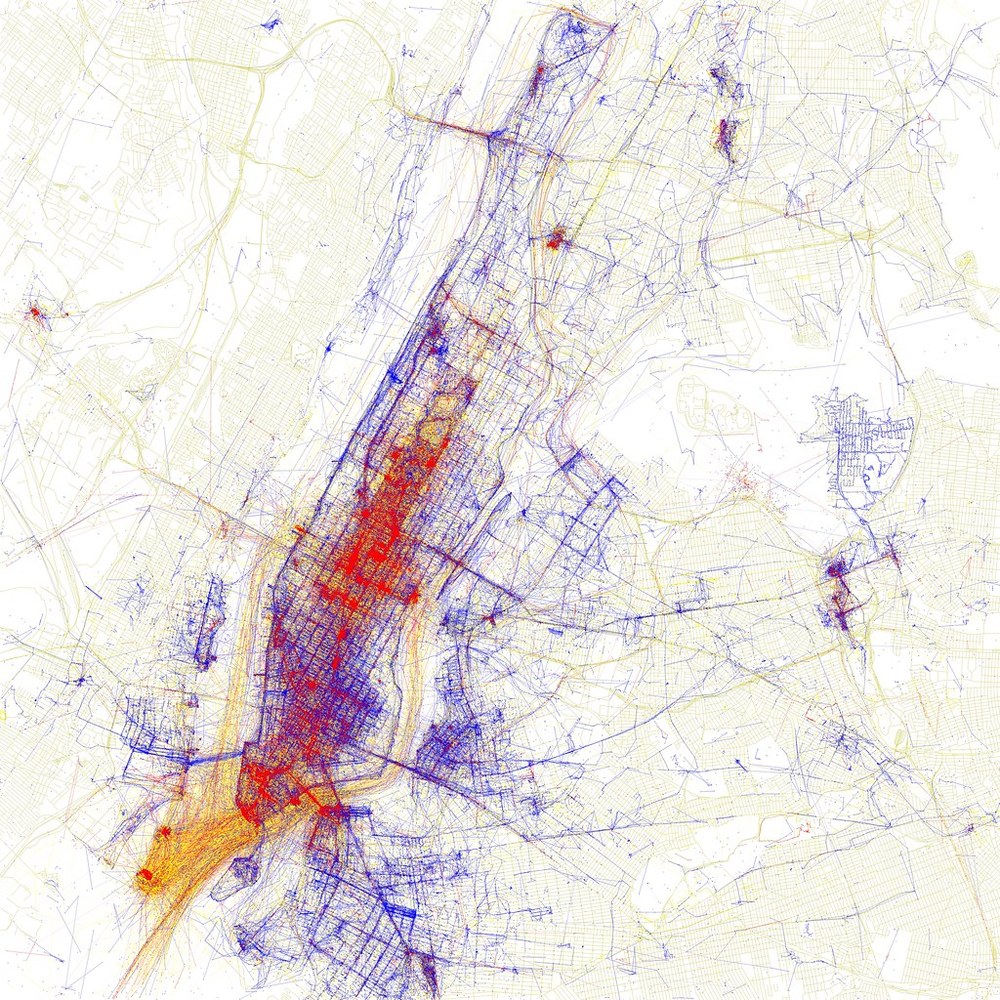
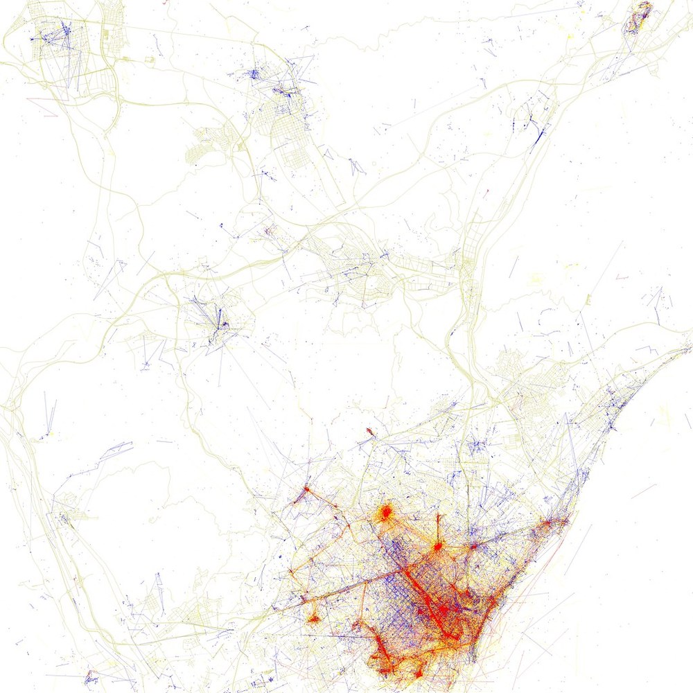
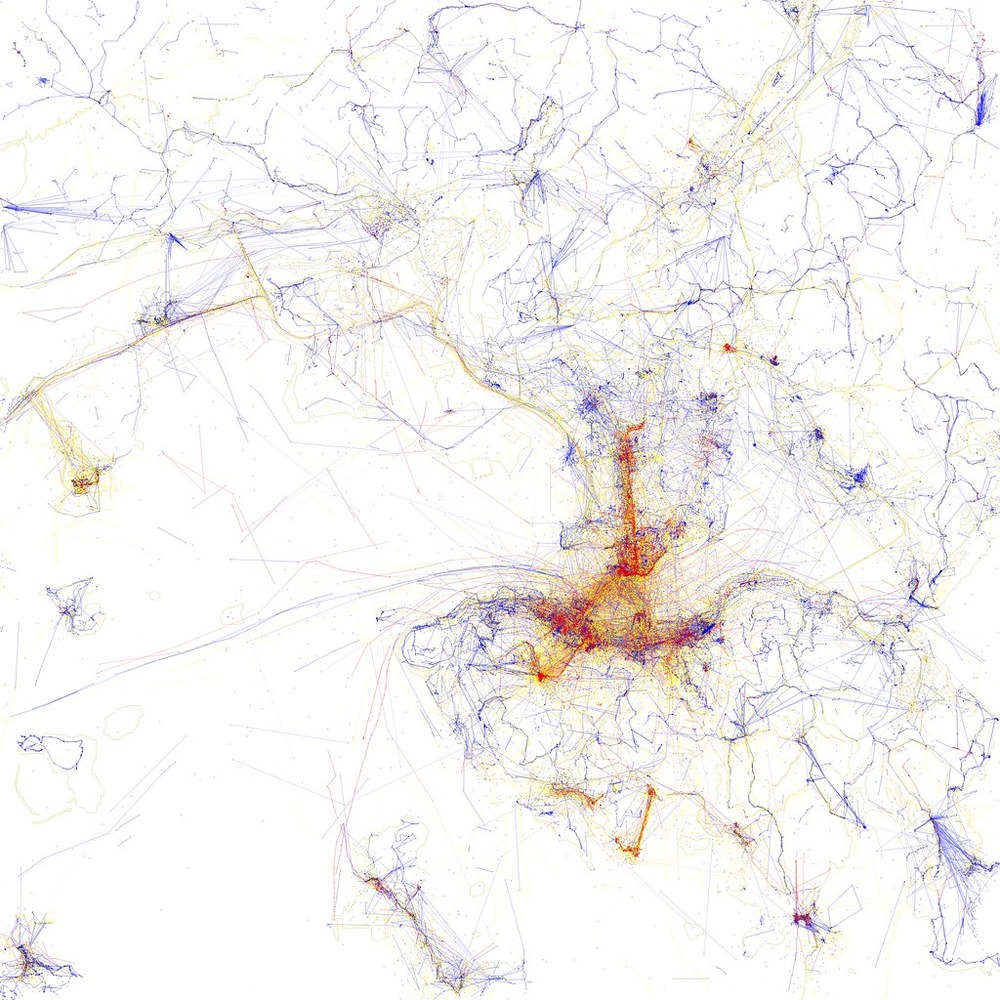
While visiting a city one has never been to before, it is common to go to touristic places, the ‘must-see’ spots advertised in the media. On the other hand, when establishing residency in a place, it is likely that one will start to attend some less popular locations, and will often spend a long time without passing by the city’s most famous touristic sights. Artist Eric Fischer has developed a project that explores precisely the difference in perceiving – and photographing – a city from the point of view of tourists and locals. The work, which is entitled Locals and Tourists, gathers the maps of 136 of the largest – and most visited – cities in the world.
Fischer used data from MapBox and Twitter to create the maps. The red dots indicate photographs taken by tourists, while the blue dots show images taken by local residents. The data were compiled between 2010 and 2013 and may be somewhat outdated, however, the main tourist attractions in large cities change very little from year to year, so it can be said that the maps reflect fairly accurately the activities of locals and tourists.
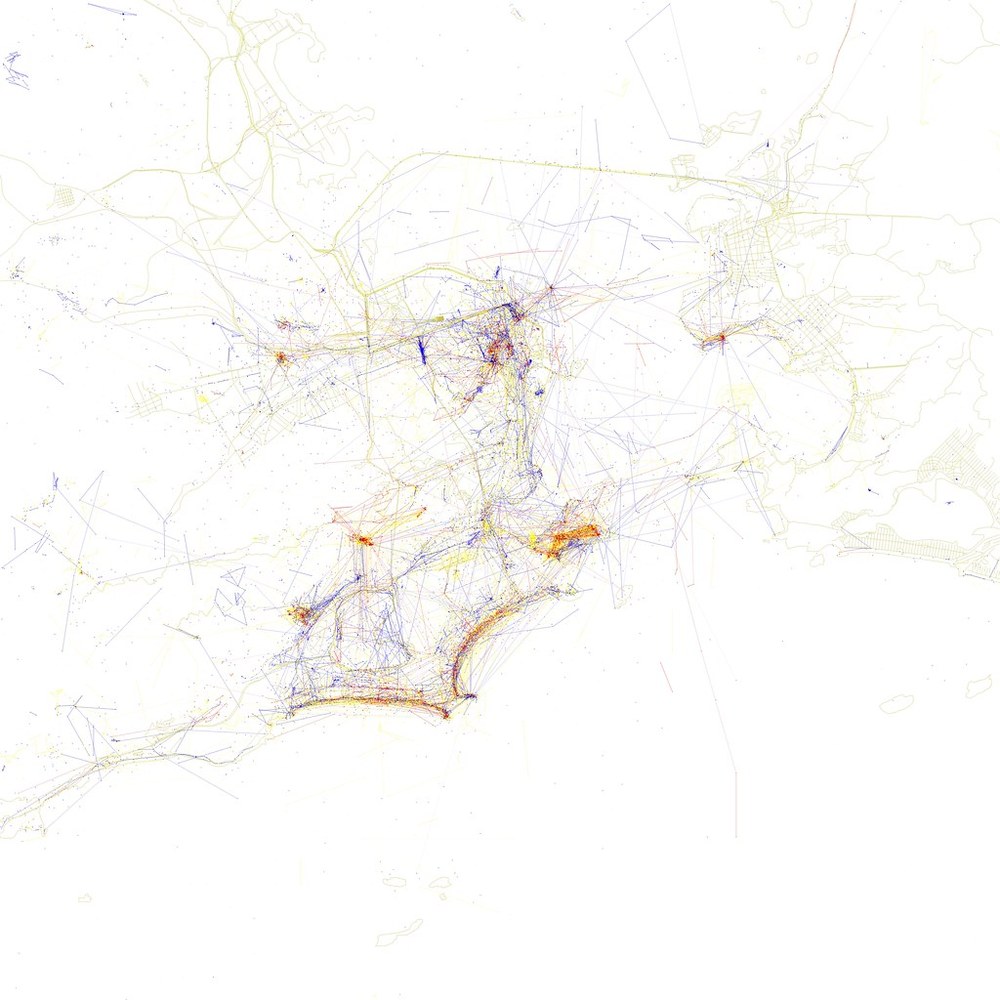
For this research, people who have been tweeting from the same city continuously within one month were considered locals. Meanwhile, tourists meant those who were considered locals in a city and tweeted from another location.
Check out some of the maps produced by Fischer below and access the full gallery here.


